
Download, print, and share these free Great Lakes education resources.
Download, print, and share these free Great Lakes education resources.
Focus areas:
")
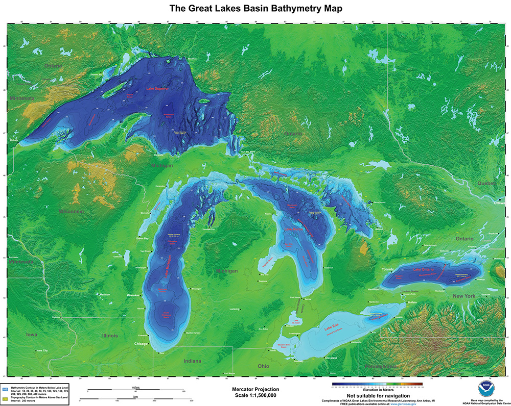
The Great Lakes Basin bathymetry map (Image credit: NOAA)
Activities and coloring pages
Posters and one pagers
- Aquatic food web offsite link
- Bathymetry of Lake Erie and Lake Saint Clair
- Fish of the Great Lakes poster
- Great Lakes basin bathymetry map
- Great Lakes food web diagrams
- Great Lakes aquatic nonindigenous species information system (GLANSIS): Poster | Watchlist poster
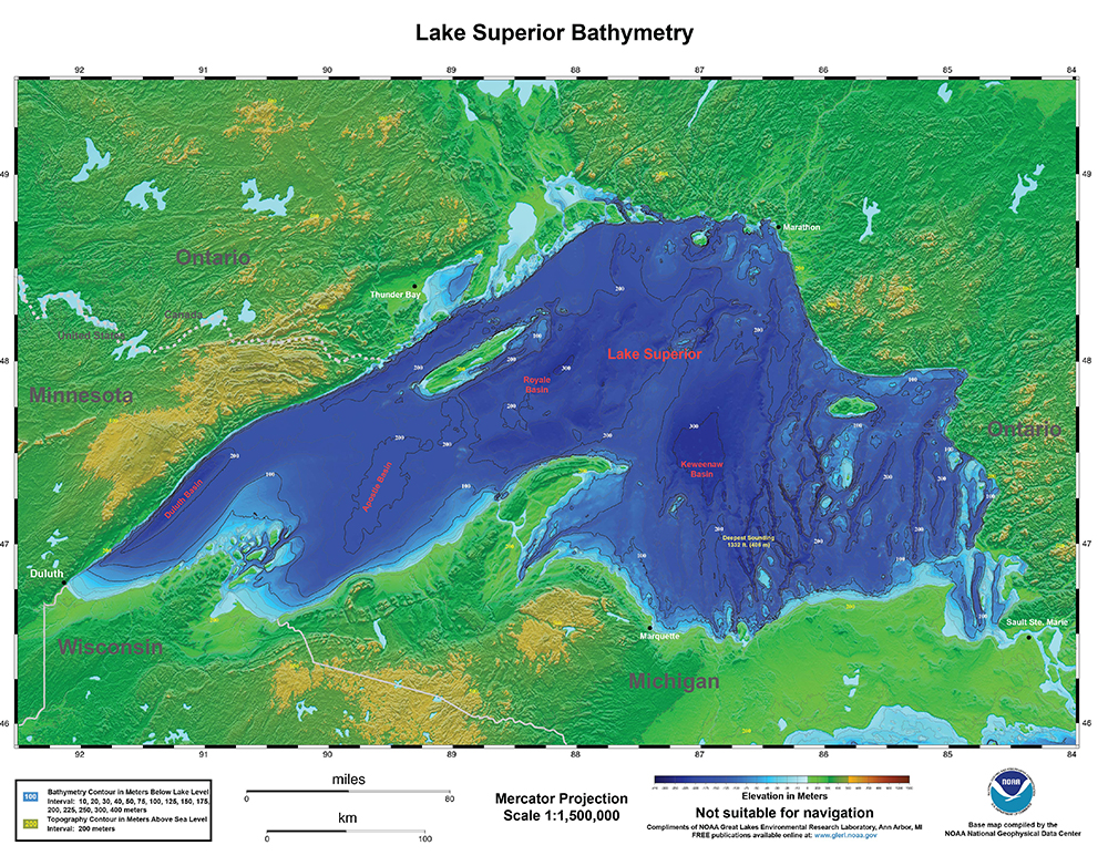
- Lake Superior bathymetry
- National Marine Sanctuary System posters
- Thunder Bay National Marine Sanctuary map